Drone Course - Information, Fee, Syllabus.
Value Addition Course
Offline
Duration: 2 days
Drone Course Information
Course Title: Orientation on Drone Surveying
Duration: 2 days
Training Modes: Offline | Full-time
Timing: 4 Hours/day
Drone Course Eligibility
- Anyone who has excited to know about how drone surveying works
- Students and faculties related to land surveying
- Directors and managers in surveying
- DPR Planner and estimator
- Officials responsible for Surveying Tender preparation
- Government officials from PWD, Town Planning, Irrigation, Agriculture, Forestry, Mining departments
Drone Course Overview
Course designed for fresher and working professionals who are excited to know how drone surveying works. This course is also conducted as workshop at colleges for their in house students.
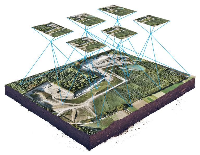
This training course will demonstrate you complete life cycle of drone land surveying project. It teaches you drone licensing, legal structure and restriction guidelines by government of India. Includes fundamental concepts and hand on exercise on, flight planning, simulation, data downloading, image processing using different photogrammetric software’s. Participant can process data them self and visualize the outcome result in different formats, no flying exercise for individuals included in the course.
Objectives Of Drone Course
- Understand Drones, History of Drone/UAS/UAVs, drone assembly, Safety, payload, battery life, specs for good results
- Explain application of drone for Surveying & Mapping like Construction, Agricultural, Engineering Land Survey and Architecture uses
- Know regulations of DGCA and Drone license, registration in India
- Know process of surveying site flight planning with different app like Drone, Deploy, Pix4D capture, GS RTK App
- Know to aerial Photogrammetry, Aerial Triangulation and how it effect accuracy
- Understand Post-process data with different app like Drone, Deploy, Pix4D
- Analyse output data, contouring, DSM and Volumetric Measurement Calculation
- Know how to produce traditional topographic map as like Total Station
- Know the kind of map/outcome can produce form drone surveying
Softwares demonstrated in Drone Course
- Pix4D
- Drone Deploy
- Agisoft
- QGIS
- Microostation
- Terra Tools
Technologies included in Drone Course
- GIS
- GPS/GNSS
- Surveying
- Photogrammetry
- LiDAR